Abandoned - not forgotten
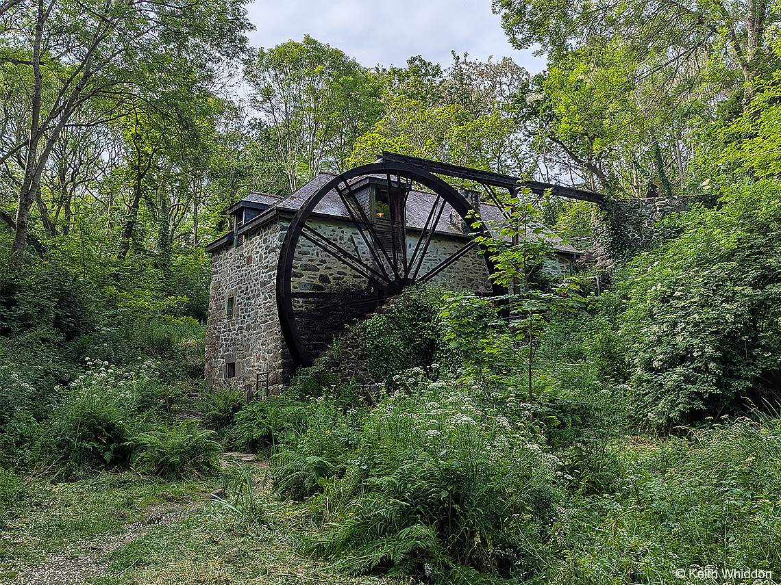
‘Moulin de Keriolet’, Finistère, Brittany
Moulin de Keriolet stands in a beautiful wooded glade, where streams run beneath huge granite boulders. It was originally built in 1868 equipped with a small horizontal wheel known as a ‘pirouette’. In 1878, to take full advantage of the waterfall, an overshot waterwheel 8 metres in diameter was installed. The Mill ground flour with 2 pairs of millstones until the 1950’s.
Looking down upon it stands Menhir Bag Sant Konogan / The Boat of St. Conogan, a Neolithic standing stone that was never erected. Its age and history is uncertain, however, its shape and orientation resembles a whale or a boat and this has given rise to a legend similar to that of St. Govan in Pembrokeshire. Sant Konogan, also known as St. Guénégan or St. Guénoc, is said to have been a monk who emigrated from Wales and crossed the Channel in this stone boat. The boat is said to have hit a large rock and 'bounced' up to the cliff top! Conogan died in 456 in nearby Lescogan, which is named after him.
 video of the waterwheel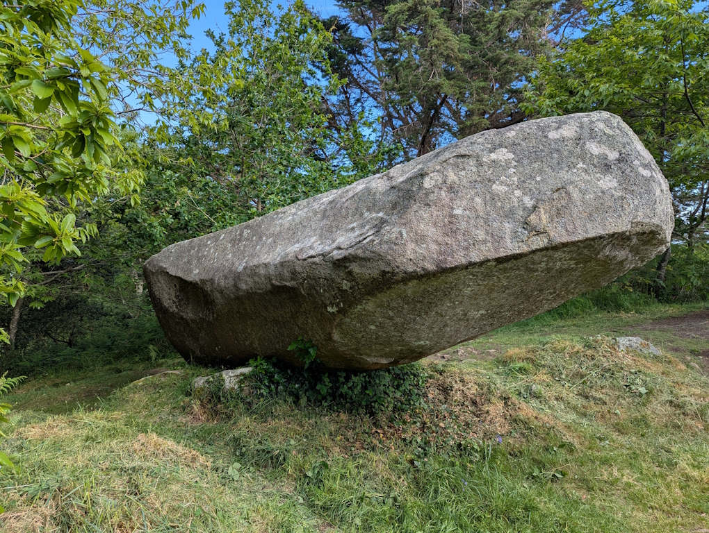
The Boat of St. Conogan (photo by Keith)
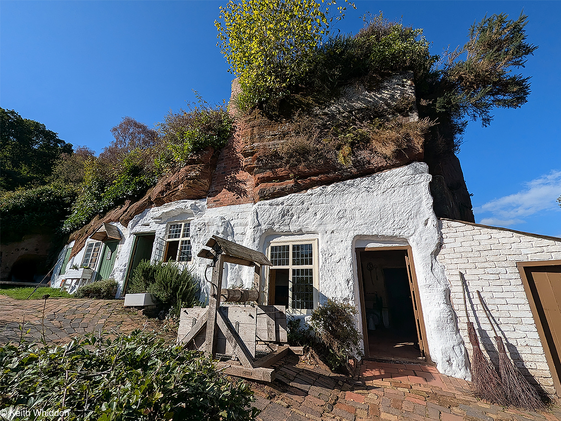
‘Rock House’, Kinver Edge, Staffordshire
Kinver Edge is a large outcrop of Bridgnorth Sandstone, a brick-red rock originally deposited by wind in a Permian desert environment. In the cliff face, several elaborate rock houses have been carved out over many centuries. The homes at Holy Austin Rock have now been restored by the National Trust and are just as they were when the houses were last lived in. It is thought that 'Holy Austin' was a hermit who inhabited a cave cell carved into the rock here prior to the English Reformation.
The earliest record of people living here is in 1777 when a Joseph Heely took refuge from a storm and was given shelter by a ‘clean and decent family’. He describes how the rock houses made good homes: ‘warm in winter, cool in summer’. By the 1861 census, 11 families were listed as living in them and the last inhabitants left as late as the 1960's, making them the last occupied cave dwellings in England.
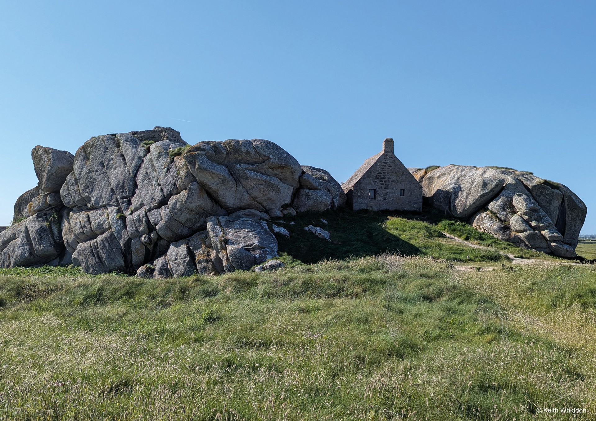
‘The Stone Watchtower’, Ménez Ham, Finistère, Brittany
This little fort nestled in between the giant granite boulders is probably the most widely used image to promote tourism in Brittany.
Ménez Ham is a tiny hamlet on the rocky shores of north-west Finistère. It owes its existence to the ‘Seven Years’ War’ when the small fort was built in 1756 between the granite rocks overlooking the sea. King Louis XIV ordered the fort's construction to defend against English invaders. Strategically positioned 21 metres above the sea, with an unobstructed view from the Pontusval lighthouse to the Île Vierge lighthouse, you could see without being seen.
A small barracks was built behind the fort which became a customs outpost in the early 1800's. When the military and customs officers finally left in the 1860's, local people inhabited the site making a poor living from fishing and harvesting seaweed to make soda cakes. They built small thatched cottages, the last of which was finally left derelict in 1977 when the village was purchased by Finistère Council to preserve and restore. It is also said that the inhabitants of Ménez Ham caused shipwrecks on this rugged coastline in order to plunder the victims washed up on the beach and the wrecks of boats!
 ‘Breton Tunes’ -
 Listen to Keith’s former band ‘Nightwatch’ from 1988
Keith playing tenor recorder, Breton Bombard and mandola
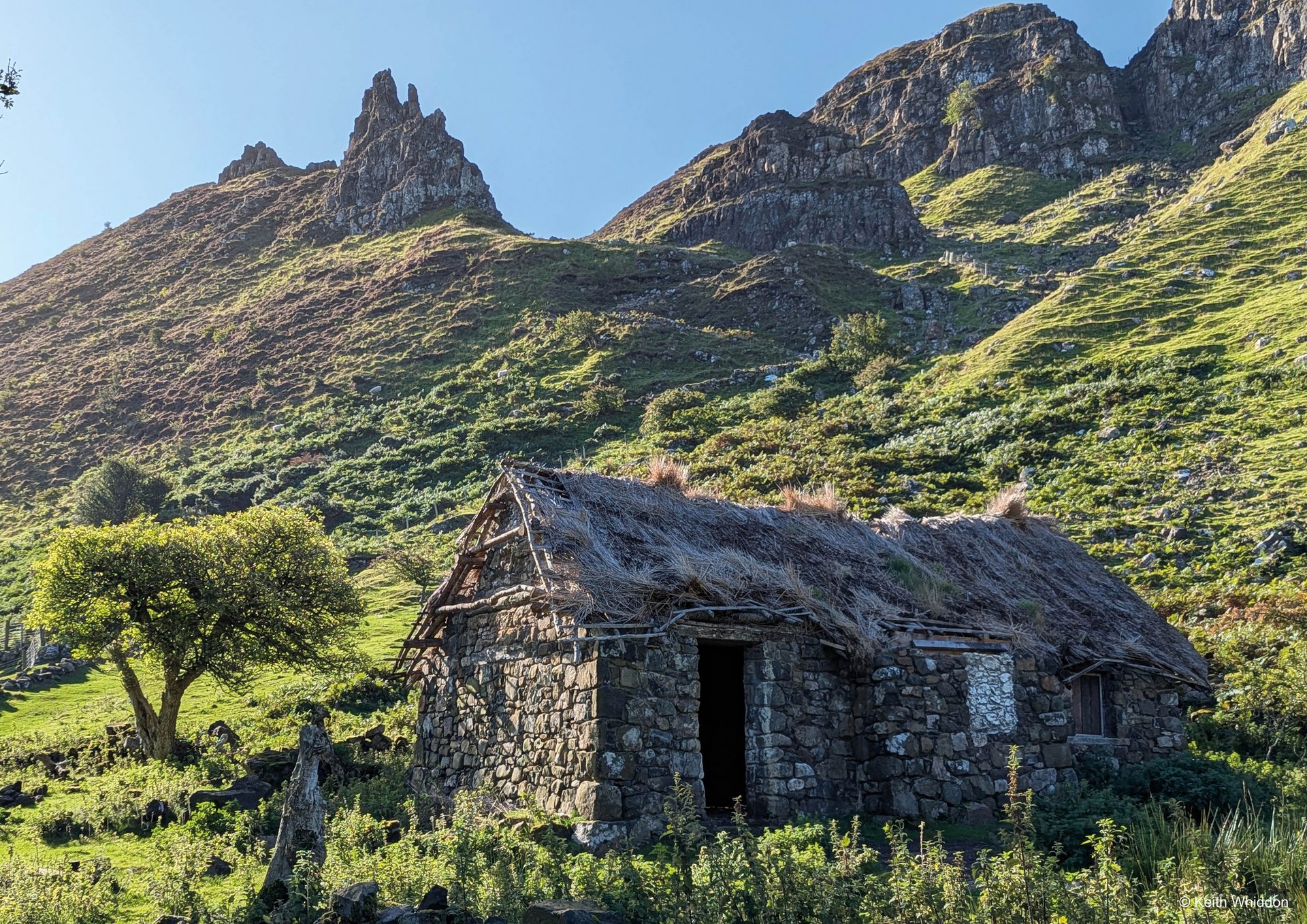
‘The Hidden Village of Gaboly’, Co Antrim, Northern Ireland
Gaboly Village lies hidden on a small terrace sandwiched between the sea and towering cliffs of chalk and basalt. Long since abandoned, this tiny farmstead was reawakened as the film set for the village of Runestone in ‘Game of Thrones’ and is now less hidden than it once was!
Once home to highwaymen who robbed traffic on the coast road below, in 1832 it comprised 10 houses and by the 1850's had a population of 60 people. The villagers practiced 'rundale' (similar to 'runrig' in Scotland), where the land was divided up to ensure that everyone had a fair share of good and bad land. In summer, boys would live higher up on the mountainside tending cattle and cutting peat - a system known as 'booleying'.
Today, now the TV crew have gone, Gaboly is one of the most peaceful and beautiful places imaginable. With the ‘Pinnacles’ towering above and the azure sea twinkling below, it is very special.
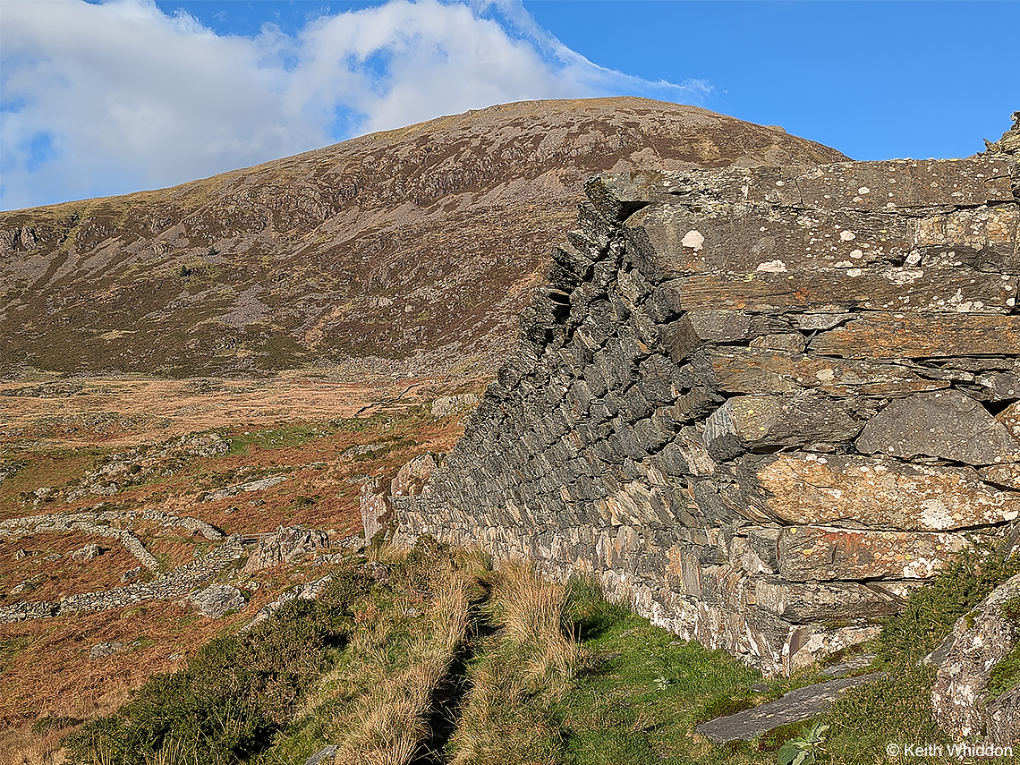
‘The Legacy of a Failed Enterprise’ - Gorseddau Quarry, North Wales
The Gorseddau Quarry is located in an area with abundant slate-bearing rock strata, but it ultimately failed as a commercial enterprise because the slate was of poor quality. Unlike in the highly successful, consistent slate veins of Blaenau Ffestiniog and Dinorwic, at Gorseddau the slate was brittle and difficult to work with. Worse, the commercially productive slate vein, while promisingly wide near the surface, quickly narrowed like a wedge as the men delved deeper underground. This made continued extraction uneconomic. It was said of the quarry, 'everything that could facilitate the works was produced, nothing being wanted but the slate vein.' It operated for just 12 years.
The most remarkable legacy of the Quarry is this amazing drystone corbelled retaining wall built around 1854. Constructed from huge, heavy blocks of cut stone at great financial cost, this massive structure leans at a dramatic 45-degree angle over the old quarry tramway. Initially designed to retain the encroaching slate waste tip, it is thought that it was planned to turn it into a tunnel as the slate waste grew and to cover the tramway completely.
Beyond lie the ruins of Treforys village. Today the ruins of its cottages stand to between 1 and 3 metres in height. There were 36 houses, 18 pairs of 2-roomed cottages laid out in 3 streets. Each house had a quarter acre of land, but it was very difficult to farm. Traces of watercourses and garden plots are still visible between the streets.
Treforys was developed in 1857 to house quarrymen and their families. The village was planned on paper in a London office and completely disregarded the rough and boggy land on which it was built. This was such a challenging place in which to live. A year after it opened smallpox broke out and within 9 years the village had been completely abandoned.
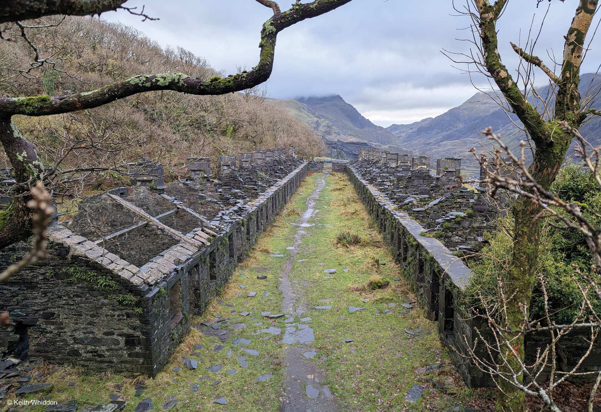
‘The Anglesey Barracks’ - Dinorwic Slate Quarry, Llanberis, Wales
Dinorwic Slate Quarry in Llanberis was the world’s 2nd largest after nearby Penrhyn. It was worked commercially from 1787 to 1969. Here the slate is Cambrian in age and the veins are vertical, so it was extracted on the surface (not from underground) by digging massive vertical pits with stepped galleries. In total, there were 40 galleries on 30 levels. The quarry was so large that it comprised of several different areas. Some of these were named after global events or places, like ‘California’ (named during the Gold Rush) and ‘Australia’ and some named after people, such as ‘Matilda’ (named after the owner's wife). At its peak, more than 3,000 men were employed.
Many of the quarry’s 3,000 workers lived locally, but others came from Anglesey. They required accommodation at the quarry each week, leaving home early on Monday and returning home Saturday afternoon. The Anglesey Barracks provided them with such accommodation.
The barracks consisted of 2 identical rows of 11 dwellings facing each other across a ‘street’. The accommodation was rudimentary - there was no electricity, toilets or running water. Each single-story dwelling was just 20 by 10 feet in size and consisted of a living room with fireplace and a bedroom for 4 men. The fireplace may have provided heat in the winter, but the men had to carry all their coal up the steep hill. The cottages were alive with vermin like fleas and rats, yet the workers were expected to pay 1 shilling to stay in the barracks each week.
In 1948 the local Public Health Inspector condemned the barracks as ‘unfit for human habitation’ and they were closed down, to be left abandoned ever since.
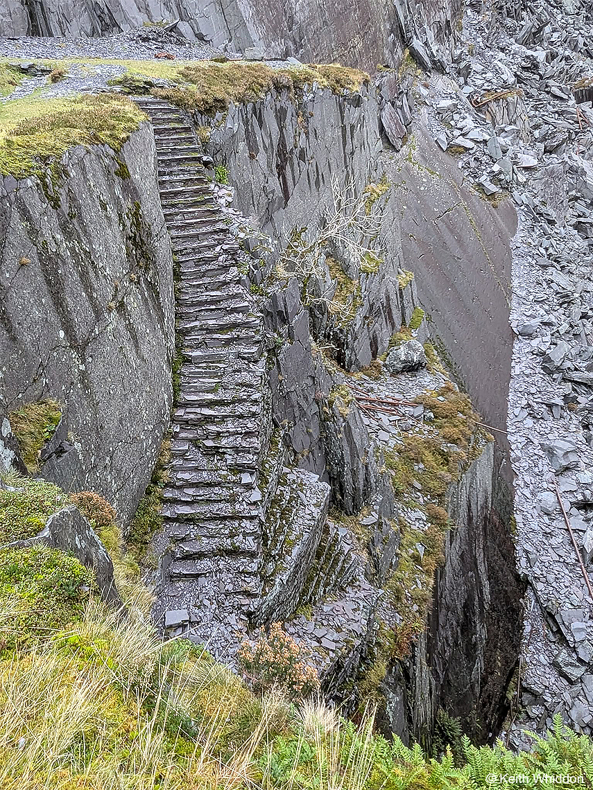
‘The Miners' Steps/Stairway to Heaven’ - Dinorwic Slate Quarry, Llanberis, Wales
The Dinorwic quarrymen constructed elaborate staircases in order to move between the various galleries to work. Since its closure the Quarry has become home to the Welsh Slate Museum and is designated a World Heritage Site. It is popular with walkers and climbers and much of its history has been preserved. With Snowdon/Yr Wyddfa as its backdrop, its many ruined buildings and machinery and its otherworldly landscapes, it has become a mecca for photographers and explorers alike.
Despite much local controversy, many of the quarry’s historic areas have been nicknamed by climbers after mythical places, such as ‘Mordor’, ‘The Lost World’ and ‘Dali's Hole’. The Miners’ Steps are now often referred to as ‘The Stairway to Heaven’.
 Video of The
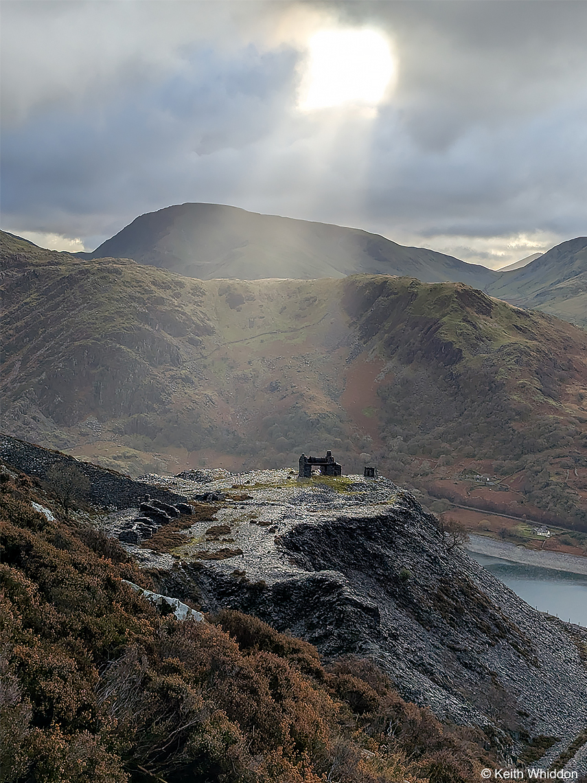
 Shaft of Sunlight over California’ - Dinorwic Slate Quarry, Llanberis, Wales
Dinorwic was so large that it comprised of several different areas. The photograph shows part of ‘California’, illuminated by a shaft of sunlight.
‘Pozzo di San Patrizio/The Well of St. Patrick’ – Orvieto, Umbria, Italy
Orvieto is a beautiful medieval hill town in Umbria, perched high on a sheer volcanic cliff. When the Etruscans inhabited Orvieto in the 5th century BC, they sank wells to provide drinking water on the hilltop. This enabled the town to endure long sieges by the Romans.
Many years later, ‘Pozzo di San Patrizio/The Well of St. Patrick’ was built by Antonio da Sangallo the Younger of Florence, at the behest of Pope Clement VII, who had taken refuge at Orvieto during the sacking of Rome in 1527. The aim was to provide water to the whole town. The well shaft is 53 metres deep with amazing double-helix spiral staircases each of about 250 steps. These ingenious staircases allowed mule-carts carrying water bags to descend one staircase and ascend the other without ever meeting.
Why St. Patrick? It is thought that the name is derived from the Irish medieval legend where Christ showed St. Patrick a well on Station Island in Donegal that was apparently an entrance to Purgatory.
The view looking down:
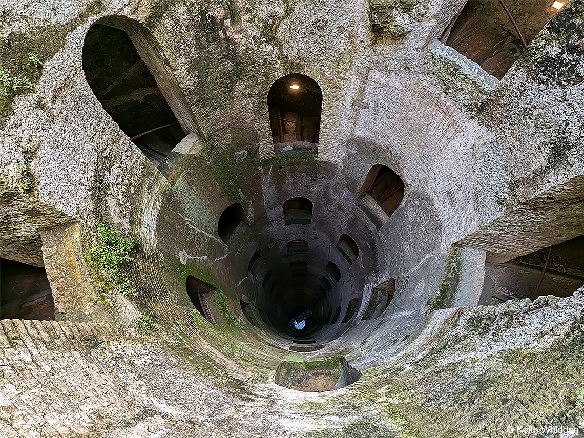
‘ The view looking down:
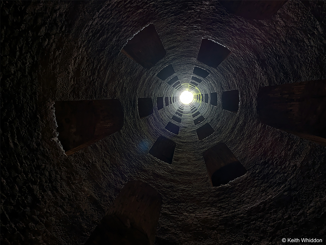 Top
Top
© Keith Whiddon 2023 - 26